
Silver Mountain Bike Park - is there a better descent in the world?
WOW - Lithium Trail - Teton Pass, Jackson Wyoming
The not so enjoyable part of Mountain Biking in Whistler
Bottom of the World - Surviving Whistler Top to Bottom
Conquering Whistler's Top of the World Trail
Fantasy Enduro - Enduro World Series Fantasy Game
Is the Thredbo AM Trail the best descent in Australia?
MTB Trail Videos - Trail Centre Upgrade Program
VIDEO: The Fourth 365 Days of Reign - My 4th year of Mountain Biking
Pilot Wilderness Ride - Cascade to Pinch - Part 2
Pilot Wilderness Ride - Cascade to Pinch - Part 1
MTB Workout for the Deskbound
Finding Bruce Ridge and Loving It!
VIDEO: Top XC Rides of 2014/2015
VIDEO: 2015 The FAIL Awakens
VIDEO: Nine Days in the Rotorua Redwoods
Exploring all of Sparrow Hill and the East Kowen Forest
VIDEO: 365 Days of Reign - The Third (year of serious mountain biking)
The New Majura Pines and Sparrow Hill Trip
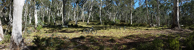
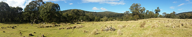
Mountain Biking in the NSW Snowy Mountains
Long term test: Yakima Highroller and Whispbar roof rack
Travelling tips for Mountain Bikers
VIDEO: Giant Anthem 29er vs Giant Reign 26
VIDEO: 2014 FAILS - Will Ride, Will Fail
VIDEO: MTB-TVs TOP 10 Descents of 2014
VIDEO: The Opening of the Alpine Epic Trail - Mt Buller
VIDEO: Wrapping up the Redwoods with a Whak-en Outrageous Ride
VIDEO: Return to the Redwoods Part IV - Eagle vs Shark
VIDEO: Return to the Redwoods Part III - XC Lower Mountain Pedally Days
VIDEO: Return to the Redwoods Part II - Heavily Rooted
VIDEO: Return to the Redwoods Part I - We're Going To The Redwoods
Video: Return to Rotorua ... ok to go!
Video: Return to Rotorua ... definitely maybe!
Video: Return to Rotorua .. maybe?
Cycology - Cycling inspired clothing
Broken Bone on Breakout
Mountain Bike Fail to Triumph in the You Yangs
365 Days of Reign - My 2nd Year on a real mountain bike
Review: the Bionicon C-Guide V2.0
Brake disk rotor size upgrade 180 to 200mm, 160 to 180mm
VIDEO: Rotorua Redwoods - Create Breathing Space
Rotorua - a Mountain Bikers Journey
Summer Mountain Bike Training at OMV
2013 Another Year of #FAIL
We're going to ride the Rotorua Redwoods
My god I love riding Stromlo Forest Park
Merry Christmas from MTB-TV - What a year its been
How to view web based KML files on your mobile device
Epic Brake Bleeding Solutions - Avid Brake Bleed Kit
The Lone Wolf enjoys some group action
Bantry Bay (Northern Beaches, Sydney)
Bruce Ridge (Canberra)
Bungarra Alpine Centre (Snowy Mountains)
Currumbin Border Track (NSW/QLD Border)
Daisy Hill (South Brisbane)
East Kowen (Kowen Pine Forest, Canberra)
Forest Pipeline (Northern Beaches, Sydney)
Fred Caterson Reserve (Castle Hill)
Golden Jubilee Field MTB Park (North Shore, Sydney)
Hassans Walls (Lithgow)
Hinze Dam (Gold Coast)
Jackson (Jackson)
Jindabyne (Snowy Mountains)
Kiwarrak State Forest (Tarree)
Majura Pines (Majura, Canberra)
Manly Dam (Northern Beaches, Sydney)
Mt Joyce (Gold Coast Hinterland)
Mt Kosciuszko (Snowy Mountains)
Nerang State Forest (Gold Coast)
Newnes (Lithgow)
Old Man's Valley (Hornsby, Sydney)
Ourimbah (Central Coast)
Oxford Falls (Northern Beaches, Sydney)
Pilot Wilderness (Snowy Mountains)
Red Hill (Northern Beaches, Sydney)
Rotorua Redwoods (New Zealand)
Silver Mountain (Kellogg)
Singleton (Hunter Valley)
Sparrow Hill (Kowen Pine Forest, Canberra)
St Ives and Belrose (North Shore, Sydney)
Stromlo Forest Park (Canberra)
Terrey Hills (Northern Beaches, Sydney)
The Oaks (Blue Mountains)
Thredbo Resort (Snowy Mountains)
Thredbo Valley Trail (Snowy Mountains)
Whistler Bike Park (Whistler)
Wingello (Southern Highlands)
Wylde MTB Trail (Cecil Park - Western Sydney)
Pilot Wilderness Ride - Cascade to Pinch - Part 2
Better prepared, better focused and better weather was the status on the morning of my second attempt to cross the Pilot Wilderness from Dead Horse Gap to the Pinch Campground via the Cascade, Ingeegoodbee and Nine Mile trails, but far from better motivated.
Full length videos of the Bobs Ridge and Nine Mile Descents at the bottom of this page.
You might think the extra two days would have given me the opportunity to come to terms with the various challenges that lay ahead however in reality my anxieties had manifested into a far bigger beast. To make matters worse my legs had got progressively sorer, to the point where my biggest concern was blowing my very tight left calf or twingey right hamstring, especially in the initial one hour climb that would begin immediately after leaving the trail head. With this in mind I made a few changes to the morning routine.
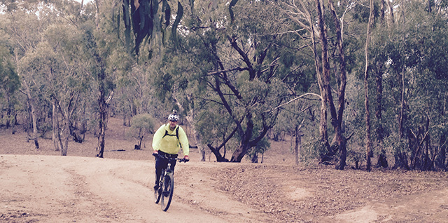
Looking toward Dead Horse Gap from the Cascade Trail
I got up early and straight out on the bike for a 2km pedal around Jindabyne. On my return I started stretching and hydrating (1.5 litres), a process that continued throughout my entire pre-departure routine. A mixture of nerves and soreness meant I still wasn't feeling inspired about the trip however as I approached Dead Horse Gap my spirits lifted courtesy of the amazing weather (5°C, not a breath of wind and not a cloud in the sky), inspirational music (as seen in the video) and caffeine.
8:20am - 5°C: After a couple of turns around the carpark I departed Dead Horse Gap totally up for it.
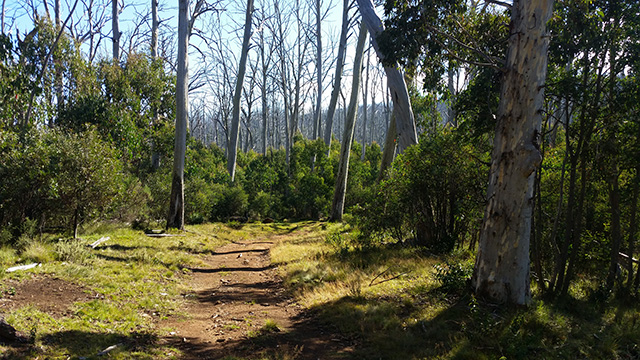
Stage 1a - Dead Horse Gap to Cascade Hut via the Cascade Trail
With the ever present concern of blowing my very tight legs I promised myself that as the climbs began to hurt I would dismount and walk. It wasn't long, a couple of hundred metres in fact, before this was put into practice. It was also around this time I crossed paths with a heavy pack laden hiker - the only person I would see for the entire journey.
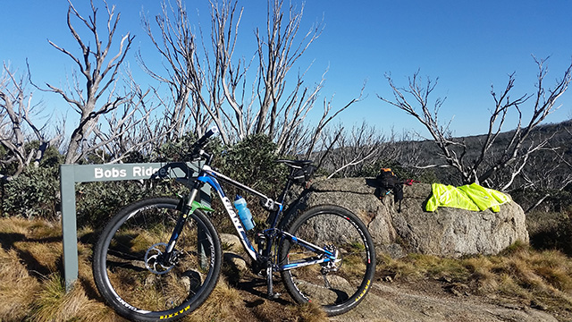
Bobs Ridge. This time I'm airing the gear due to sweat rather than rain. One hour in and ready to get serious.
I arrived at the top of Bob's Ridge slower than I'd done in the rain but that was testament to my leg management plan. Excited and enthusiastic about what the day would bring I texted my support crew of my intention to go, layered up and powered off down the descent to Cascade Creek. (9:25am 5°C)
In 2014 I rode my first real mountain bike down this hill and pushed myself well outside my comfort zone. With a few years riding under my belt this time I was in my element throwing the bike down the superfast and flowy fire trail with minimal braking. There was only one sketchy moment that had me a little too close to disappearing off the edge than I would have liked, but that being said I was laughing at the time. Thus far it had been an exhilarating start to the day with brilliant weather and an awesome descent topped off by following an antlered Buck for about 200m down the trail (albeit an introduced species that should be eradicated from our National Parks).
First stop was the Cascade Hut. Like all huts along this route the turn off was unmarked and the hut was not clearly visible from the trail. The location of all the huts in relation to corners, climbs and descents was info I'd committed to memory, aided by a check on the GPS every now and then. Important information that in an emergency could save my life. Having visited the Cascade Hut before I didn't stay long, it was simply an opportunity to eat some breakfast and switch to padded fingerless gloves. The temperature had risen to a barmy 7°C but the sun was out - brilliant!
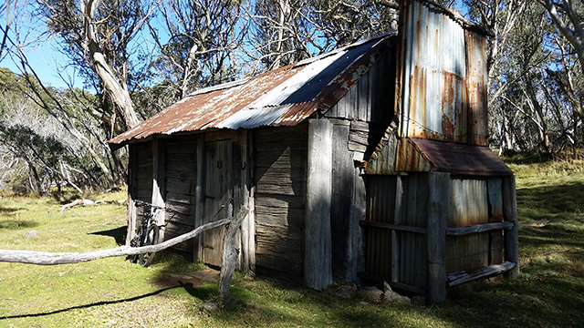
Cascade Hut
Stage 1b - Cascade Hut to Tin Mines Huts via the Cascade Trail
Only back on the trail for 100m I came face to face with my first wild brumby. This brumby was not the stuff of poems and legend it was the ugliest, mangiest, 3rd world horse you could imagine. While a little edgy it seemed to be content to remain where it was as I passed not 10m away.
With mangy horse behind me I was welcomed by the first of what would be many many many flowy and fast descents. Despite having looked at the KML (Google Earth trail download) and elevation graphs for what probably amounted to days I don't think I'd really appreciated how much descending would be on this ride. I'd been burned by what I thought was going to be a 40km descent at the Alpine Epic so in hindsight I'd gone into this adventure with tempered expectations of what the descent and climb data really meant.
Remnants of the 2003 Bush Fires on the Cascade Trail. At times the thick regrowth looked like an orchard.
There is no doubting that the initial climb to Bob's Ridge was a bugger of a climb however for the remainder of the trip there were only a few short pinch climbs that would be beyond the capabilities of the average fit XC rider. I on the other hand always erred on the side of caution. As soon as there was the slightest twinge of pain or over effort I got off the bike and walked. Not only did that save the big muscles from injury or over use but by walking it worked them differently, especially my calves and achilles which in fact got a really good stretch while walking up the hills.
Enough about the handful of times I had to get off the bike, the vast majority of the ride was flat or undulating with lots and lots of long winding descents, many that lasted 2-3 minutes even at balls-out-no-brakes pace. A 3 minute descent is a long descent, you cover a lot of distance in that time.
While this journey was all fire trail for the most part it was double track littered with fallen branches, sticks, leaves, rocks and horse shit. I have an aversion to braking on fire trails so flying down the many long gradient-friendly descents had me on my toes like any fast single track. It was exhilarating having to continually move the bike around the track, from track to track, down the grass median strip and occasionally French Enduro right off the track in an attempt to avoid objects that may destroy a dérailleur, rim, spoke or tyre. Certainly not your average XC fire trail plod!
I mentioned horse shit, there is a lot of it - lots and lots of horse shit. A besquillion square kilometres of bush and they have to crap on the 2ft wide track - the bastards! I don't know if this happens elsewhere but the wild brumbies like to crap in the same place building up large mounds that can get well above knee height and not only do they crap on the trail they'll crap on both tracks at the same spot creating an unavoidable situation. Maybe the intention is to spread their scent via the bikes and parks vehicles as they roll through it, who knows, but after a few hours trying to dodge or bunny hop over it I stopped caring.
#Protip: have a front mud guard and ride with your mouth closed especially when crossing any water.
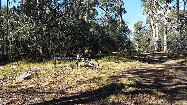
The intersection of the Tin Mines and Cascade Trails
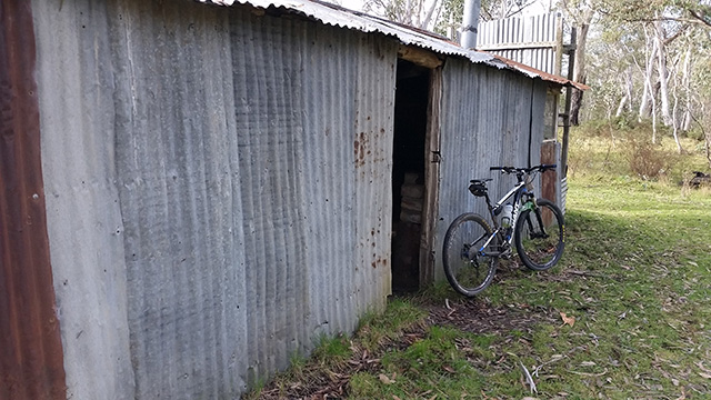
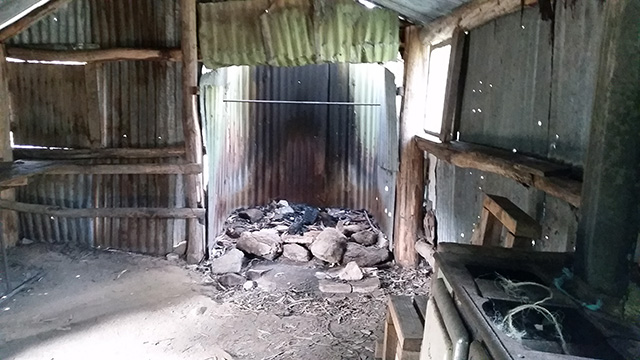
The next main intersection was with the Tin Mines Trail and not long after were the Tin Mines Huts. The Tin Mines Huts are fully maintained huts from the pre National Park era when the area was heavily farmed and mined for tin. These huts are well worth a visit and are of course fully functioning adventurer huts. All of the huts had fire places but while they're quite robust they all had holes in the roofs and walls - in truth they are survival huts not holiday cabins. Some of the huts had rudimentary bunks that would support a hiking mat and some had chairs and tables. For more information on the snowy mountains huts check out their website. To reiterate my point - knowing the whereabouts of the huts on a trip like this is absolutely critical!
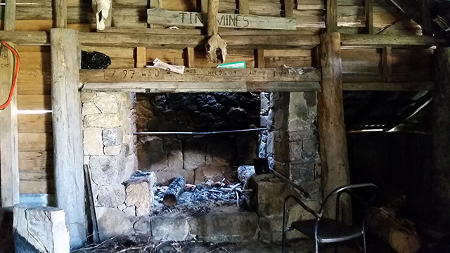
Tin Mines Hut, quite rustic but well decked out.
Opening the doors on these unoccupied huts was spooky and quite frankly I didn't like spending time inside them on my own, the Blair Witch vibe was screwing with my brain however I did push myself to have my lunch in one of the Tin Mines Huts as it was getting a bit hot in the sun despite being only 10°C.
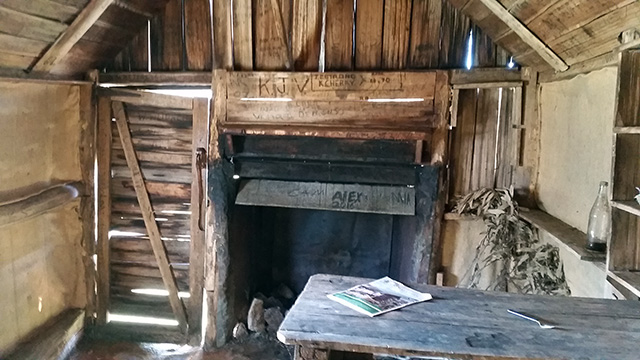
The smaller of the two Tin Mines Huts. It feels far creepier and dark inside than the photo reveals.
Stage 2 - Tin Mines Huts to the Nine Mile Trail via Ingeegoodbee Trail
I arrived at the Tin Mines Huts ahead of schedule and left 10 mins late. TBH I'm not sure where the time went, but I was quite surprised to see I was departing behind schedule.
Just prior to leaving I sent a text to my support crew advising them I was roughly on schedule (they had a copy of my trail notes) and while I didn't expect to find any connection the SMS was successfully sent a short time later and as luck would have it my support crew were passing through the last moments of mobile signal on Barry Way when it arrived (around the end of the sealed section). Unbeknownst to me I'd received a response back from them within 25 min, so it's probably worth noting that with Telstra there were opportunities to get SMS messages out in case of emergency but I suspect you would need to keep moving to find minute pockets of stray signals. (note: 3G signal at best, definitely no data)
The trail Intersection of the Cascade Trail, Cowombat Trail and the Ingeegoodbee Trail.
Tin Mines Huts are behind me down the hill.
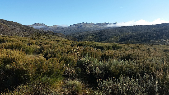
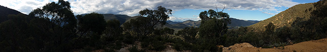
From above the Tin Mines Huts the Cascade Trail ends, the Cowombat Trail heads out toward the Pilot (a big mountain peak) and the Ingeegoodbee Trail begins. At this point in the ride the landscape appears to be typical Aussie Bush, with little to identify its alpine proximity over most other native bush. There were a number of large open grassy areas, a mix of tall and small gums, quite different from the extremely tall and green alpine bush on the southern slopes of the ridge I'd been riding along thus far.
It was within this stretch that I came across my second wild brumby only this time it was a spectacular dark brown stallion, definitely a specimen worthy of poems and legend. He was not happy to see me at all and stormed off into the bush huffing and puffing. I heard quite a lot of dissatisfaction coming from the trees so I got out of there pretty quick with one eye looking behind me. Not long after I came across my second deer, a doe who disappeared so quickly barely a shadow is visible on the GoPro footage.
With no notable features or intersections along this stretch I'd memorised the elevation patterns between the Tin Mines Huts and the Nine Mile Trail so I could gauge my location. Three climbs (2 woops and table top) before a nice long descent, followed by another climb that then drops down to large open area followed by a big climb out. But I felt like I'd been descending a lot and hadn't registered any of the 4 big climbs.
These are situations where smart travellers check their locations while dumb ones continue on and end up in the news. There really wasn't much I could have done wrong but I knew I was 6 hours into the journey and in a state of exhaustion - which is exactly the sort of situation where I could make a tragically bad mistake. My situation didn't add up so I stopped to check my location. Then double and triple checked. I was on track, in fact I'd passed all four climbs and was well on my way down the flowy descent into the open valley (see the KML).
To be beyond the climbs was a huge surprise and something I was very happy about. That's not to say they weren't climbs and I had walked parts of all four, but they weren't that big. Maybe a couple steep ones in a similar vein to the big climb on Long Track in Terrey Hills but nothing remotely near the length and gradient as the climb from Ding Ding Ding to Escalator in East Kowen, and vertically speaking it didn't feel like what was on the charts. It was a brilliant piece of motivation to have got through a tough section so easily, especially this far into the ride.
A large clearing on the Ingeegoodbee Trail. The big river crossing is not far ahead.
To see the valley open up at the end of the my final descent of the Ingeegoodbee Trail was a moment to be celebrated, but the thrill of making it this far came with great anxiety - the next river crossing was the big one, the one I'd been warned could be armpit deep, the same one that kept me awake at night. I approached with much trepidation.
The gully was deep, the crossing was wide. At either end of the crossing were fallen trees and branches at varying depths. This crossing was a death trap! Lose your footing and you could be swept into the entangled nest of fallen trees and be trapped. If you didn't drown you'd die from hypothermia in the near freezing water. And it's not like you can just head up stream a bit to find another crossing as the horses have destroyed all the edges of the creeks and rivers turning the underwater creek beds into bogs, it would have been a long long bush bash up stream to find a safe place to cross.
#Protip: Do this trip in autumn as I did.
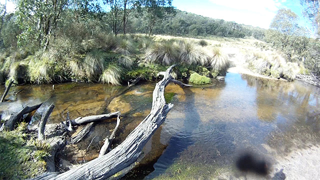
Not something you want to wade across during the spring snow thaw!
For me the water was only up to the bottom bracket and I rode across. It was far from the chest deep death trap I'd been warned about. You have NO IDEA how relieved I was! Another big - oh thank god that's over moment! Two in the last half hour.
On the other side was a huge climb up to the Nine Mile Trail, the second biggest climb on the ride, parts of which that would be too steep and loose for all but the strongest of MTB climbers. So steep in fact that even the horses had created their own track off to the side that zig zagged its way up - thanks brumby folk for that one!
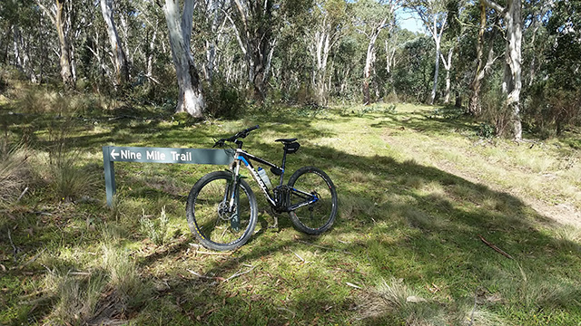
Nine Mile Trail forking off from the Ingeegoodbee Trail.
Ingeegoodbee Hut is down a trail directly opposite the Nine Mile Trail.
The intersection of the Nine Mile Trail was a welcome relief. This was the point where I knew I'd made it. From here it was simple climb up the Nine Mile Trail before the final descent to the Pinch Campground. A HUGE descent that was the primary motivation for riding across the Pilot Wilderness, a HUGE descent of approximately 1000m vertical drop over just 5.8km. But with almost 7 hours of riding behind me it was time for a rest so I took the unmarked trail to the Ingeegoodbee Hut 100m away.
Ingeegoodbee Hut
Ingeegoodbee Hut was the most modern of all the huts on this ride and the biggest, it also felt the most like a serial killer lair. With that in mind I downed a gel, inhaled a muesli bar and GTFO of there.
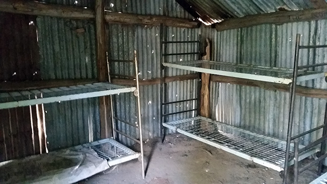
Some huts had bunks, but the Ingeegoodbee Hut had a number of them in working order.
Before starting off at the beginning of the day I'd estimated I'd be half an hour ahead of my conservative schedule. On-trail, based on the ease of the climbs and number of unexpected long descents and the speed with which I was flying down them I figured I'd be an hour ahead of schedule. I got quite a shock to see that I'd kept time and was still 10 mins behind. That being said I'd been pretty conservative on how long it would take me to descend the Nine Mile Trail. I had a Strava KOM in my sights and strongly believed I would be going home with the glory, it would mean I'd pick up a good 10-15mins and be back on schedule.
Ingeegoodbee Hut. All metal walls and roof unlike the other huts that were mostly clad with timber.
The climb from the Ingeegoodbee Trail to the top of Nine Mile Trail was steady and I definitely underestimated how much I would have to walk, however I was keen to save all remaining energy and caffeine buzz for the descent. I checked my location, sealed up the layers, put on the full finger gloves, cleaned the glasses and checked the GoPro. I was locked and loaded for my final mission.
Stage 3 - Nine Mile Trail - The Descent to the Pinch Campground
WOOO ... The trail was awesome. A fast descending gradient, good clear water bars, plenty of stuff to avoid, good lines and fast corners. Wooing and yelling, jumping off the water bars I was absolutely in my element ... and then it got real. Crazy steep real, crazy loose real, crazy tight corners real, crazy I can't see the bottom real, crazy blind corner off a water bar can't see landing in off camber gravel with a cliff drop off to the side real ... and then ... "OH SHIT I CAN'T STOP !!!"
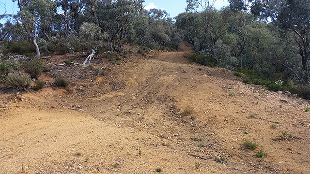
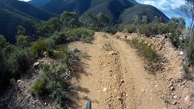
A pretty typical section of steep fire trail with big water bars and plenty of loose stuff on the surface. 5.8km of this!
The descent had been so long, so fast and so steep that my brakes were fading. As I mentioned earlier I have an aversion to braking on fire trails so I'd gone a long way on this descent with little to no braking but as the trail got steeper the situation had changed, it had been minutes with only a few split seconds off the brakes. My arms were gone and even though I'd moved my braking fingers to the absolute ends of the levers to maximise braking capacity I still couldn't squeeze hard enough to stop. I was yelling in pain Arrrrggghhh calling on every ounce of strength to slow the bike as I approached corners and water bars. I was focusing so hard on trying to slow down that I'd forgotten all technique, I was stiff on the bike and not concentrating on riding line. I was fighting to squeeze the brakes while looking for anything to help stop the bike. I even attempted to pull off the track a couple of times but I physically couldn't stop the bike so I had to turn back on.
I made some REALLY stupid decisions some that got me into dangerous ruts with deep gravel and massive rocks. It was good luck more than skill that kept me upright.
Salvation came in form of a flattish clearing after a section where the gradient had eased slightly, however the seriousness of the situation became very clear when even on the flat I couldn't stop the bike - ultimately I had to use my feet Flintstones-style to bring myself to a halt.
The Nine Mile Trail looking into the Pinch River Valley. A stop I'd not expected to make.
I got off the bike, took off my helmet, gloves and pack, bent over to suck in the big ones, looked up and said Oh fuck, I'm only halfway down! (not quite true, it turns out I was about 3/4 of the way down but still a long way to descend)
I wished I'd kept the camera running at this point because the commentary was choice. It went something like this.
"Right Strava Record - that's done. I'm going to sit here long enough so there is no possible way I can get it because that is so off the table it's not funny. I'm also going to let the brakes cool right down. I need to stretch my arms because if I cramp up I'm dead. I'm going to work out how the hell I am going to get down this! Actually this is very serious, how can I get down this alive?" (There was a lot of swearing ... basically in every spot you could possibly put a swear word).
I was scared, really, really scared. I seriously considered walking as continuing on with failing brakes was just crazy! I spent roughly ten minutes assessing my desire to live before setting myself some rules, rules that I said out loud and can be heard in the video.
"Ok Aaron, this is what we're going to do, because this is fucken dangerous. We're going to keep it to about a jogging pace .. if we can. Every single water bar we're going to bring it right back down to near walking (pace). Every clearing we're going to stop. We're going to take this really cool, calm and collected. Ok, cool, calm, collected, slow and in control .. and no panic. "
To say the worst was over would be a lie in fact the trail got much tougher however with a new appreciation for my situation I attacked the lower half of the descent with greater respect. But it wasn't all roses. Fear had put me right off my game, situations that I normally would have blasted through I was out of control with the bike was twisting and skating, I was riding stiff and fighting off a state of panic. The occasional open flatter section gave me an opportunity to get off the brakes and put a smile on my face however as I approached each tricky section I would remind myself to SLOW DOWN - literally instructing myself out load.
The view on the lower section of the Nine Mile Trail descent was amazing,
but as you can see my eyes were focused on the trail.
It was in this section where some of the best views of the valley were available, but at this point they were of little interest to me. I was 100% focused on survival.
#Protip: There's a gate on the lower section that comes with no warning and is totally hidden below a blind water bar. Death trap!!
I can't explain how I knew but instinctively I realised when I'd made the bottom and it was confirmed shortly after as I noticed the Pinch River off to my left.
I'd got down, holy crap I'd got down!
Wow what a ride!
The face of a very tired but immensely satisfied rider
I can't put into words the euphoria as I rode the final kilometres of undulating trail to Barry Way. I'd made it - 57km my biggest ride, I'd done it without injury and without so much as a cramp, in fact my legs felt better than they did when I set off. I'd survived the final descent and was only 34 mins outside of the ETA I'd put together using a slide rule and fairy dust.
Looking back the things that will remain with me are the things that were a surprise. To have been so close to wild brumbies and deer, to have ridden so many long and amazingly fun flowy descents, to have been next-to-spot-on with my ETAs throughout the whole journey. To have fought-to-survive rather than enjoyed the bit that I thought would be the highlight but to have gotten so much more out of the rest of the journey than I could have possibly imagined.
It truly was an amazing adventure and never say never .. I may ride it again one day.
Notes on the final descent:
I really enjoy descending but this descent is next level. I hadn't really thought about how steep it would be but if I'd compared the gradient (i.e. drop vs distance) to the descent on the way back from Bobs Ridge to Dead Horse Gap I would have realised it was the same distance but 4 times the descent (1000m as opposed to 230m) - ie 4x steeper. In hindsight, that might have been enough to turn me off attempting this ride.
Long sections of the descent are very similar to the fire trail coming from the Kosciuszko Express at Thredbo down to the start of the single tracks. However consider that I was not on a downhill bike or even an all mountain bike, I was on a 100mm XC Bike with 2.1 Crossmarks, a XC helmet and no pads. But also consider a trail like the Thredbo Fire Trail stretching for 5.8km with only a handful of flatter sections to regather yourself. Consider that it had taken 7 hours of riding to get to the start and that it was a 14 minute descent that took me 34 minutes to get down. It's truly next level.
If you're not comfortable riding steep, loose and long descents then is worth reconsidering whether you should be attempting a difficult descent like this in such remote country after already riding some 50km.
The not so minor details
Anthem Mods
- 57km - My longest ever ride by 10km
- 7hr 34min on-trail time - my longest by 22mins
- 5hr 21min moving time - my longest by 51mins
- 1150m vertical climb - my 2nd biggest climb (Alpine Epic 1280m)
Bike
- Anthem X 29er - 2012 bits on a 2014 frame
- Upgrades for this ride:
- DH brake pads - for obvious reasons
- KS Lev 150mm dropper post - more reliable than my Giant Command Post and an extra 50mm drop (taken from the Reign)
- Shimano PD-M530 Pedals - platforms for reduced fatigue (from the Reign)
Fluids
- 2L water (backpack)
- 2x 600ml Powerade (backpack)
- 1x 600ml Water bottle with Powerade (on the bike constantly refilled from my backpack reducing the backpack weight)
Food
- 2x Muesli bars (out of 4)
- 2x Gels (out of 4)
- 1x Ziplock bag of Red Frogs (out of 2)
- 4x Salt tablets
- 1x NoDoz
Pre-ride
- 1x Protein Shake
- 1x 600ml Powerade
- 1x Redbull
In the hour post ride
- 1x Protein Shake
- 1L Water
- 2 rows Chocolate
Clothes
- Most of the journey - full-length compression tights, knicks, MTB shorts, HiVis SS shirt, HiVis wind jacket, short finger gloves, overshoes.
- Start and end of the journey - as above with LS compression top and full finger gloves
- Additional clothes not used - thermal top, dry pair of full-length gloves, head warmer
Spares and Gear
- Standard MTB spares and tools - with double the usual: tubes, CO2 cylinders and chain links
- Matches and lighter stowed separately, space blanket, wraps of gaffer and electrical tape, various levels of painkillers and anti-inflammatories, water tabs, mini towel.
- Three GoPro Batteries and 3 memory cards (34gb of footage recorded).
- When on long rides I Velcro a cheap digital watch to my top tube. This is not only to monitor my progress but also to remind me to eat and drink every half hour.
What I'd do differently
I was very happy with how everything panned out. My selection of gear, route preparation and on-trail performance was pretty well spot on. Here are a few things I would do differently.
Sat-phones - both for me and my support crew and ideally a SPOT for me. I won't do another trip like this without sat-phones at a minimum, for the peace of mind of my support crew if nothing else. A SPOT has EPIRB features but is far more useful as you can send messages.
Brakes - ideally DH brakes but without question I would put on at least 200/180mm rotors (I rode Elixir 9s with 180/160mm rotors) and brand new pads for the ride letting them settle in over the journey (which I did).
It turns out my rear callipers sprung a leak and while I still had plenty of brake pressure the DOT fluid was all over the pads and rotor meaning I couldn't lock the back wheel at any speed no matter how hard I squeezed. Without back brakes my 112kg + gear mass was being transferred to the 180mm rotors on the front chewing through the front pads to the point where they were down to the spreading clip. Obviously the brake failures were the crux of my final descent issues however I still wouldn't do it again without bigger rotors and higher spec brakes not to mention an even more intense forearm training regime.
Tyre pressure - My tyres were at 30psi to decrease the chance of puncture, I usually run at about 27psi. I would highly recommend running higher pressures even if you ride tubeless due to the number of sticks and rocks on the trail. I'd intended on dropping the pressure for the final descent but I totally forgot. It would have made a huge difference on that final descent with less pressure.
Stop and smell the roses - I was enjoying the descents so much that I failed to stop at the locations with the best view. On the sections that were flat I found the trees obscured the view so the only photos I have are of my bike leaning against trail signs and trees. Watching the GoPro footage I can see that the descents between Bobs Ridge and the Tin Mines Trail have some amazing views of the Murray River valley, as does the final descent on the Nine Mile Trail.
Weather - Ideally mildly warmer, 10-15°C is perfect in my opinion once into the 20s being able to carry enough water is a problem and the streams are not drinkable. I'd question whether boiling and the use of water tabs would be enough to make the creek water drinkable, it looked to me as though the brumbies have turned the creeks putrid.
Trail notes - I did a pretty good job with my Trail Notes, however it would have been worth putting additional reminders such as dropping tyre pressure on the final descent. This is where a strip of Elastoplast on the top tube can be really handy for writing trail notes and reminders.
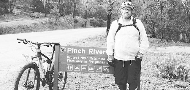
Arriving at the Pinch Campground
If you have any questions about this ride please don't hesitate to ask. It was a tremendous adventure in an amazing part of the Australian wilderness. If you have the equipment, skills and experience to tackle this trail you won't be disappointed.
If you haven't already, read what it took to get on this ride in Part I
Links To Info
- Strava Ride of my successful attempt
- Strava Ride of my aborted attempt
- Google Map of driving route to Pinch Campground
- NPWS in Jindabyne
- KML (Google Earth File)
- Trail Notes
Trail Centres and Trails featured in this blog
- East Kowen (Kowen Pine Forest, Canberra, ACT)
- Pilot Wilderness (Snowy Mountains, NSW)
- Terrey Hills (Northern Beaches, Sydney, NSW)
- Thredbo Resort (Snowy Mountains, NSW)