
Bantry Bay (Northern Beaches, Sydney)
Bruce Ridge (Canberra)
Bungarra Alpine Centre (Snowy Mountains)
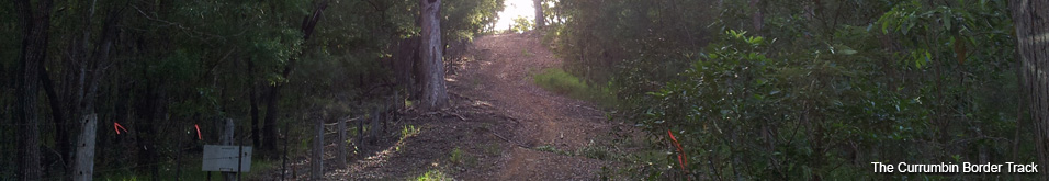
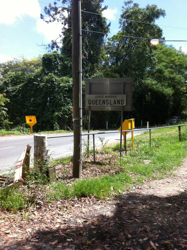
Currumbin Border Track (NSW/QLD Border)
Daisy Hill (South Brisbane)
East Kowen (Kowen Pine Forest, Canberra)
Forest Pipeline (Northern Beaches, Sydney)
Fred Caterson Reserve (Castle Hill)
Golden Jubilee Field MTB Park (North Shore, Sydney)
Hassans Walls (Lithgow)
Hinze Dam (Gold Coast)
Jackson (Jackson)
Jindabyne (Snowy Mountains)
Kiwarrak State Forest (Tarree)
Majura Pines (Majura, Canberra)
Manly Dam (Northern Beaches, Sydney)
Mt Joyce (Gold Coast Hinterland)
Mt Kosciuszko (Snowy Mountains)
Nerang State Forest (Gold Coast)
Newnes (Lithgow)
Old Man's Valley (Hornsby, Sydney)
Ourimbah (Central Coast)
Oxford Falls (Northern Beaches, Sydney)
Pilot Wilderness (Snowy Mountains)
Red Hill (Northern Beaches, Sydney)
Rotorua Redwoods (New Zealand)
Silver Mountain (Kellogg)
Singleton (Hunter Valley)
Sparrow Hill (Kowen Pine Forest, Canberra)
St Ives and Belrose (North Shore, Sydney)
Stromlo Forest Park (Canberra)
Terrey Hills (Northern Beaches, Sydney)
The Oaks (Blue Mountains)
Thredbo Resort (Snowy Mountains)
Thredbo Valley Trail (Snowy Mountains)
Whistler Bike Park (Whistler)
Wingello (Southern Highlands)
Wylde MTB Trail (Cecil Park - Western Sydney)
Currumbin Waters Gate to Piggabeen Rd (4.00km)
Currumbin Border TrackLast Update: 6/11/2013
Some trail names are made up, if there is a different name please let us know.
Difficulty - Easy - Intermediate
Slope - Flat - Moderate - Undulating - Steep
Space - Open - Tight
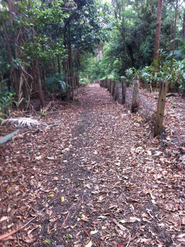
Surface - Dirt - Eternal Puddles - Grass - Gravel - Heavy leaf and branch litter - Loose rocks on dirt - Loose rocks on rock - Rock - Roots - Rutted
Trail type - Double track - Firetrail
Notes:
There are few places to go off-road around Tweed Heads but this trail just up the road is a little gem.
Well not so little, from the information I can put together the trail runs from Currumbin Waters along the NSW / QLD border all the way to South Australia! It links up with the Dingo Fence that starts further north and from the intersection of NSW, QLD and SA then forks off in a number of directions. It would make for one hell of a ride .. but mostly through desert. It's quite an interesting read as it forms the longest man made structure in the world.
I've covered a 4km section from Currumbin Waters (QLD) up to Piggabeen Rd.
There are a number of entrances to the crown land running behind the houses at Currumbin Waters. I entered through one of a number of vacant blocks on Sawtell Street however at some point the land will be built on and access blocked. There appeared to be access from Wilkinson Cres however the narrow gap between the houses looked very steep and I was hesitant to be strolling around through peoples yards in the early morning. I expect that the best entry will be from Hoffschildt Street which will lead straight to the gate, avoiding the uneventful nature strip at the back of all the houses (no trail as such just grass).
The map shows some of the locations you can probably get onto the trail, you may even be able to get on it closer to the motorway if you really want to be adventurous.
The video starts from the gate above Hoffschildt Street.
While there is evidence that the trail is used by runners, riders and the occasional service vehicle it obviously doesn't get a lot of traffic. In sections of double track the grass is so high it grows over the tyre channels and you can't see the dirt track underneath. I found that a little disconcerting due to the large amount of rocks, branches and general tree litter on the trail.
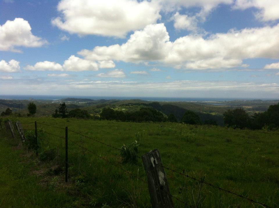
There are some nice clear sections as well and a number lose rocky sections typically on the steeper climbs and descents. With the exception of one very long steep hill most of the climbs are short separated by cruisey sections that are generally very straight.
The 4km I rode climbed about 100m on the way out meaning the return ride was much easier, however the biggest climb was on the way back. The photo doesn't do it justice (click on the image to see a larger version)
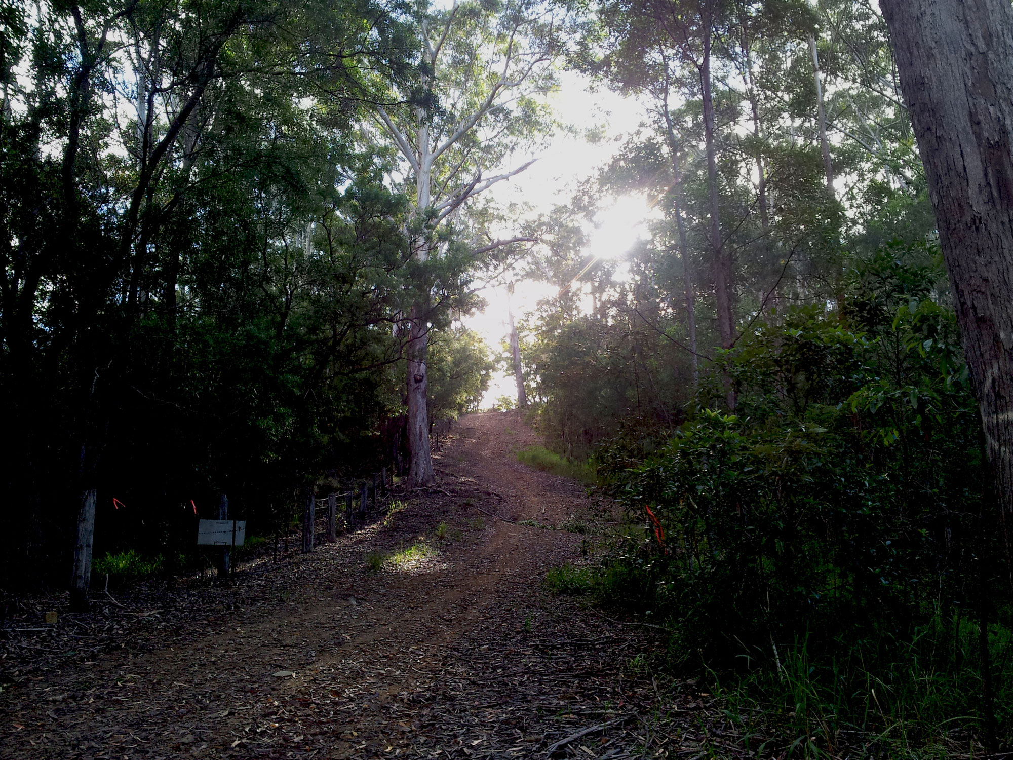
As mentioned there is a lot of loose tree litter on the trail so it pays to be vigilant.
Special thanks to MTB local Shane who has given us some great info about other sections of the trail and to everyone on the forums at MTB Dirt for their tips about riding in SEQ.
Story and photos by Shane
(click on the images to see a larger version)
I live close by (the border track) and around Christmas 2012 I finally bit the bullet and rode the border track starting from the cattle grid at the top of Tomewin Rd.
It was quite the adventure, the first kilometre or two was so overgrown. I mean like basically impassable. At times I was crawling and dragging my bike under lantana. It was pretty heavy to be honest and got to the point I was really questioning what I had got myself into.
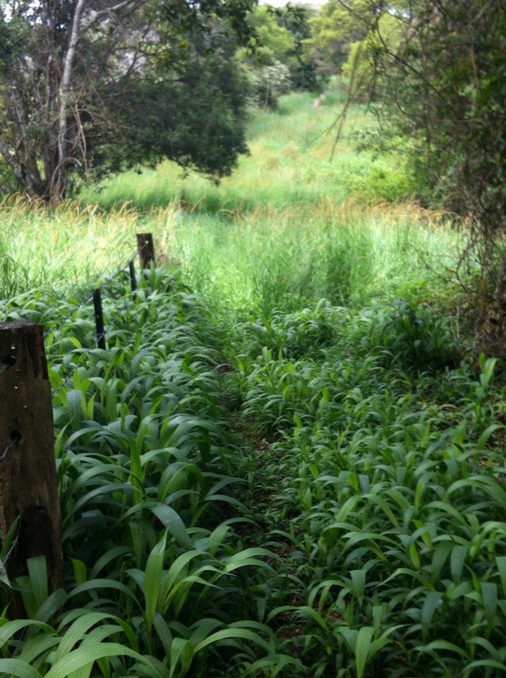
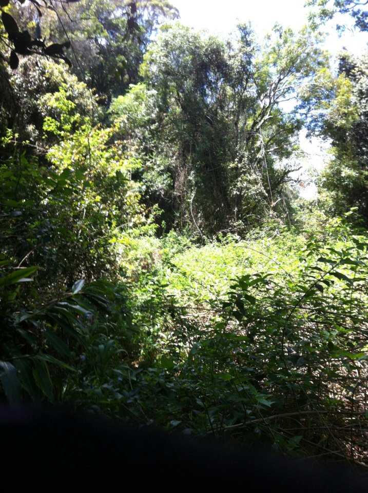
But, eventually it got better and started to open up a bit, but still not that riding friendly.
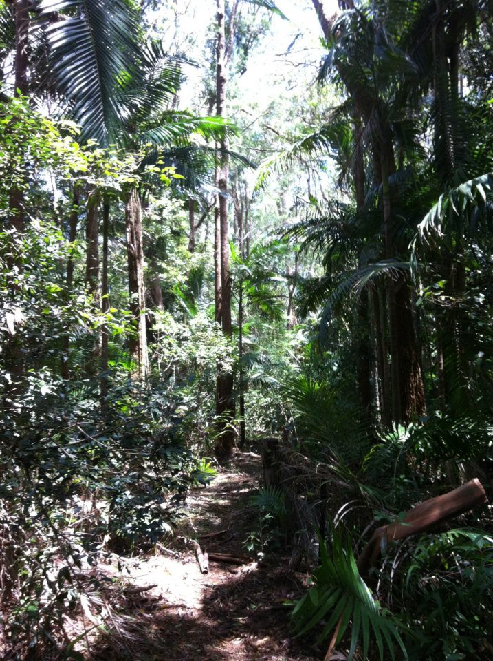
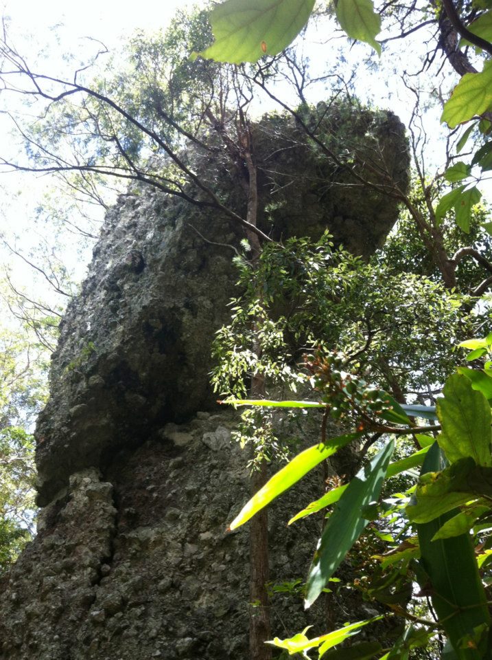
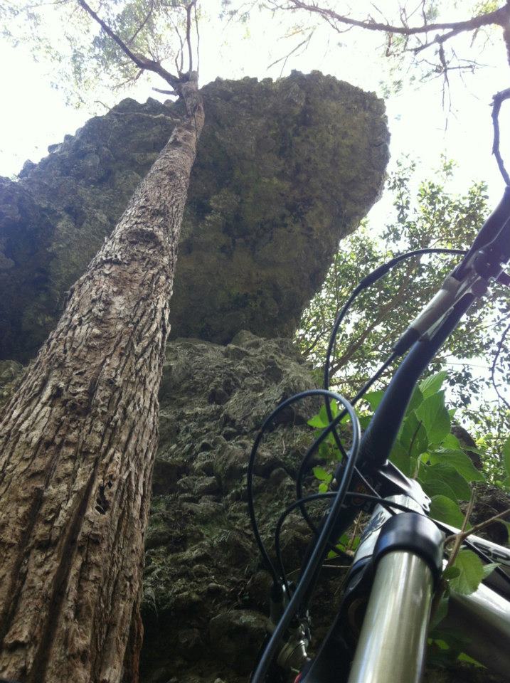
The next part was a real surprise and very welcomed after the way things started. I believe it is called hanging rock and it's pretty damn impressive - perched on top of a very fine ridgeline. This is where a cleaner trail begun.
Finally some clear trail...
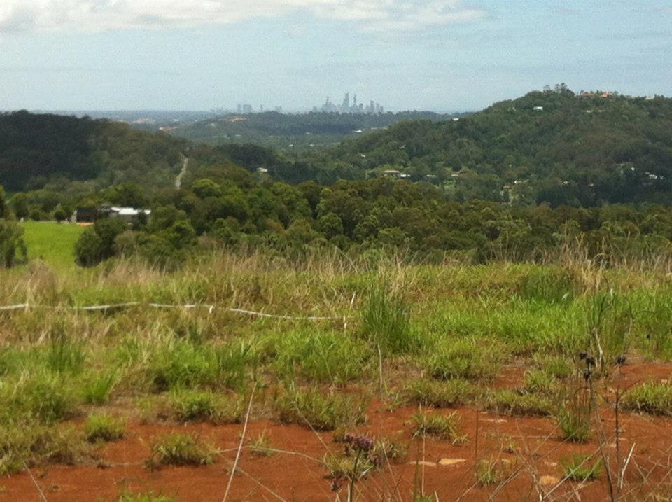
As you get closer to the coast there are some impressive views
By the end my arms and legs were covered in what seemed like hundreds of super fine lantana scratches, unbelievable! Took weeks for them all to heal and the scars to disappear.
Would I do it again... probably not. Not really my thing. But am I glad I did it? .. hell yeah.
I have since ran a section of it (from the eastern gate to the eco village) and think I would prefer running over over riding it.