
Bantry Bay (Northern Beaches, Sydney)
Bruce Ridge (Canberra)
Bungarra Alpine Centre (Snowy Mountains)
Currumbin Border Track (NSW/QLD Border)
Daisy Hill (South Brisbane)
East Kowen (Kowen Pine Forest, Canberra)
Forest Pipeline (Northern Beaches, Sydney)
Fred Caterson Reserve (Castle Hill)
Golden Jubilee Field MTB Park (North Shore, Sydney)
Hassans Walls (Lithgow)
Hinze Dam (Gold Coast)
Jackson (Jackson)
Jindabyne (Snowy Mountains)
Kiwarrak State Forest (Tarree)
Majura Pines (Majura, Canberra)
Manly Dam (Northern Beaches, Sydney)
Mt Joyce (Gold Coast Hinterland)
Mt Kosciuszko (Snowy Mountains)
Nerang State Forest (Gold Coast)
Newnes (Lithgow)
Old Man's Valley (Hornsby, Sydney)
Ourimbah (Central Coast)
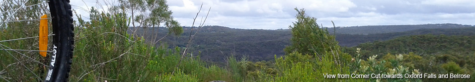
Oxford Falls (Northern Beaches, Sydney)
Pilot Wilderness (Snowy Mountains)
Red Hill (Northern Beaches, Sydney)
Rotorua Redwoods (New Zealand)
Silver Mountain (Kellogg)
Singleton (Hunter Valley)
Sparrow Hill (Kowen Pine Forest, Canberra)
St Ives and Belrose (North Shore, Sydney)
Stromlo Forest Park (Canberra)
Terrey Hills (Northern Beaches, Sydney)
The Oaks (Blue Mountains)
Thredbo Resort (Snowy Mountains)
Thredbo Valley Trail (Snowy Mountains)
Whistler Bike Park (Whistler)
Wingello (Southern Highlands)
Wylde MTB Trail (Cecil Park - Western Sydney)
Beacon Hill to Allambie Rd (645m)
Forest PipelineLast Update: 6/11/2013
Some trail names are made up, if there is a different name please let us know.
Difficulty - Easy
Slope - Flat - Moderate - Undulating - Steep
Space - Open
Surface - Dirt - Grass - Rock
Trail type - Firetrail
Notes:
The first section of the Forest Pipeline Track runs from Goroka Park at the south end of Government Rd in Beacon Hill through to the lights at Allambie Rd and Mortain Ave.
From Goroka Park follow Ethie Rd to the west but before the corner drop down the grassed area to the left, through gates and follow the pipeline. This pipe runs (above ground for the most part) all the way to St Ives!
The first descent is grassy and reasonably steep with some rough rocky options available for those looking for a bit of action. Its quite easy to pick up speed down this section however be aware its not completely smooth, it does see a lot of pedestrian traffic and there is potential for stray pets to cause you significant grief!
(Riding the other way is a decent climb! The grass its tougher than it looks and the rough sections add insult to injury.)
At the bottom there is a short grassy climb up to the gate at Mortain Ave. On the other side of the road the grassy climb gets tougher as the trail heads up to Allambie Rd.
This section is hardly worth riding on its own but its a small segment off-road that can be used to link Red Hill and Manly Dam and or the rest of the Forest Pipeline Track.
Goroka Park also has a very short section of single track. From the top corner of the park near the swings a track heads off toward the south, winding its way through the small patch of bush before turning to the east and exiting at clearing on Goroka Place.