
Bantry Bay (Northern Beaches, Sydney)
Bruce Ridge (Canberra)
Bungarra Alpine Centre (Snowy Mountains)
Currumbin Border Track (NSW/QLD Border)
Daisy Hill (South Brisbane)
East Kowen (Kowen Pine Forest, Canberra)
Forest Pipeline (Northern Beaches, Sydney)
Fred Caterson Reserve (Castle Hill)
Golden Jubilee Field MTB Park (North Shore, Sydney)
Hassans Walls (Lithgow)
Hinze Dam (Gold Coast)
Jackson (Jackson)
Jindabyne (Snowy Mountains)
Kiwarrak State Forest (Tarree)
Majura Pines (Majura, Canberra)
Manly Dam (Northern Beaches, Sydney)
Mt Joyce (Gold Coast Hinterland)
Mt Kosciuszko (Snowy Mountains)
Nerang State Forest (Gold Coast)
Newnes (Lithgow)
Old Man's Valley (Hornsby, Sydney)
Ourimbah (Central Coast)
Oxford Falls (Northern Beaches, Sydney)
Pilot Wilderness (Snowy Mountains)
Red Hill (Northern Beaches, Sydney)
Rotorua Redwoods (New Zealand)
Silver Mountain (Kellogg)
Singleton (Hunter Valley)
Sparrow Hill (Kowen Pine Forest, Canberra)
St Ives and Belrose (North Shore, Sydney)
Stromlo Forest Park (Canberra)
Terrey Hills (Northern Beaches, Sydney)
The Oaks (Blue Mountains)
Thredbo Resort (Snowy Mountains)
Thredbo Valley Trail (Snowy Mountains)
Whistler Bike Park (Whistler)
Wingello (Southern Highlands)
Wylde MTB Trail (Cecil Park - Western Sydney)
St Helena Trail Intersection to The Helipad (4.67km)
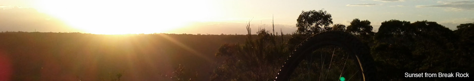
The OaksLast Update: 4/11/2012
Some trail names are made up, if there is a different name please let us know.
Difficulty - Easy - Intermediate
Slope - Moderate - Undulating - Steep
Space - Open
Surface - Dirt - Loose rocks on dirt - Sand
Trail type - Firetrail
Notes:
The section between the St Helena Track turn off and the Helipad is pretty straight forward fire trail. Largely uphill with a few short but steep downhill rides, this section will test your fitness! (but the rewards will come in the next section).
The video of this section starts with me expressing complete dissatisfaction at the extended climb ahead of me. It doesnt look that steep on the video and who can remember if it was, however Id got this far non stop and I was HURTING! But with every climb comes a descent and a bigger more taxing climb but thats nothing! Sadly Im not joking!
Use my breathing on the video as an intensity meter.
7:50 - Who the hell has the energy to ride down that technical - I couldnt even look at it?
9:00 - Im praying .. apparently
10:00 - Im having an out-of-body experience
10:34 - I no longer enjoy mountain biking
11:56 - WTF THAT GUY JUST RODE UP 1000M OF VERT !!
12:30 - Oh wow .. this is almost flat
13:00 - Still climbing
15:00 - STILL climbing
15:41 - Some relief with a long descent
16:00 - Toilet break (note: if you go into this corner too fast that will be the last corner you ever attempt - BIG CLIFF)
16:20 - Safety ramp?
16:30 - LET HER RIP
17:00 - NOOOOOOOOOOOOOOOO!!!
21:40 - Highland Fling riders out training (yes it was the same guy who rode past the other way a few mins earlier - I think hes trapped in the Matrix)
24:00 - Still climbing
27:00 - Climbing again
28:35 - The Helipad - Never too tired to say Hi!