
Bantry Bay (Northern Beaches, Sydney)
Bruce Ridge (Canberra)
Bungarra Alpine Centre (Snowy Mountains)
Currumbin Border Track (NSW/QLD Border)
Daisy Hill (South Brisbane)
East Kowen (Kowen Pine Forest, Canberra)
Forest Pipeline (Northern Beaches, Sydney)
Fred Caterson Reserve (Castle Hill)
Golden Jubilee Field MTB Park (North Shore, Sydney)
Hassans Walls (Lithgow)
Hinze Dam (Gold Coast)
Jackson (Jackson)
Jindabyne (Snowy Mountains)
Kiwarrak State Forest (Tarree)
Majura Pines (Majura, Canberra)
Manly Dam (Northern Beaches, Sydney)
Mt Joyce (Gold Coast Hinterland)
Mt Kosciuszko (Snowy Mountains)
Nerang State Forest (Gold Coast)
Newnes (Lithgow)
Old Man's Valley (Hornsby, Sydney)
Ourimbah (Central Coast)
Oxford Falls (Northern Beaches, Sydney)
Pilot Wilderness (Snowy Mountains)
Red Hill (Northern Beaches, Sydney)
Rotorua Redwoods (New Zealand)
Silver Mountain (Kellogg)
Singleton (Hunter Valley)
Sparrow Hill (Kowen Pine Forest, Canberra)
St Ives and Belrose (North Shore, Sydney)
Stromlo Forest Park (Canberra)
Terrey Hills (Northern Beaches, Sydney)
The Oaks (Blue Mountains)
Thredbo Resort (Snowy Mountains)
Thredbo Valley Trail (Snowy Mountains)
Whistler Bike Park (Whistler)
Wingello (Southern Highlands)
Wylde MTB Trail (Cecil Park - Western Sydney)
Ryland Track (3.51km)
St Ives and BelroseLast Update: 24/3/2013
Some trail names are made up, if there is a different name please let us know.
Difficulty - Easy
Slope - Flat - Undulating
Space - Open
Surface - Dirt - Eternal Puddles - Heavy leaf and branch litter - Loose rocks on dirt - Loose rocks on rock - Rock - Rutted - Sand
Trail type - Firetrail
Notes:
Ryland comprises of a main fire trail with a number of offshoots (Ryland 1st Left and Ryland 2nd Left) all providing access to very large power towers throughout the Ku-ring-gai Chase National Park. Ryland is the main trail running from Mona Vale road to the Cooyong Track (otherwise known as "To Sandys" or "Kierans Creek") and then off into the bush above Kierans and Cowan Creeks.
There is room to pull off and park on Mona Vale Rd just beyond the gate, alternatively park near the fruit market and ride the St Ives Horse Track from Forestway to the Ryland Track.
Many riders use Ryland as a way to access the trails surrounding Terrey Hills. It links perfectly with the trails coming up from Cascades via the Ridge Top Track / Quarry Track and the trails coming from the Wildflower Gardens area of St Ives.
Ryland has a number of small sandy sections, there are also a few water bars but the trail from Mona Vale Rd to the intersection of the Cooyong Track is quite flat. In this section there are also two fire trails that head off to the left Ryland 1st Left and Ryland 2nd Left. Both are out and back trails leading to large power towers.
The 3rd trail on the left is actually the remainder of the Ryland Track. The trail that veers to the right (or what appears to be straight ahead) is the Cooyong Track; it eventually links up with the Sandy Track coming down from the southern edge of Terrey Hills.
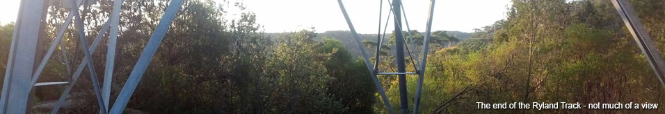
The Ryland Track from the Cooyong intersection on wards is more overgrown. It's quite evident that not a lot of people ride it. The second half simply goes out and back and despite leading so far out into the bush the view is quite poor in comparison to other trails. I'm sure you could find some nice views if you went for a short walk but from the view from the trail consists of a bloody big power tower surrounded by a 8ft wall of scrub.
That being said I found the trail quite fun to ride. A few rocky sections, plenty of loose rocks and plenty of sticks and branches make the trail far more interesting than your average high traffic fire trail; it also contains a few steep sections that I couldn't find enough traction to climb.
On the final stage of this trail there is a 50m diversion to the right featuring a RIDICULOUSLY steep ride down to another tower. While it provides a notably better view than the end of the main Ryland Track there is little point descending just to walk back up.