
Silver Mountain Bike Park - is there a better descent in the world?
WOW - Lithium Trail - Teton Pass, Jackson Wyoming
The not so enjoyable part of Mountain Biking in Whistler
Bottom of the World - Surviving Whistler Top to Bottom
Conquering Whistler's Top of the World Trail
Fantasy Enduro - Enduro World Series Fantasy Game
Is the Thredbo AM Trail the best descent in Australia?
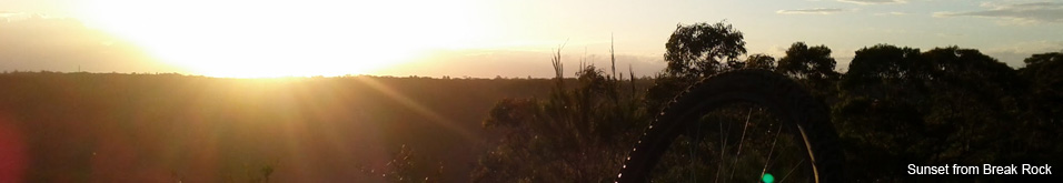
MTB Trail Videos - Trail Centre Upgrade Program
VIDEO: The Fourth 365 Days of Reign - My 4th year of Mountain Biking
Pilot Wilderness Ride - Cascade to Pinch - Part 2
Pilot Wilderness Ride - Cascade to Pinch - Part 1
MTB Workout for the Deskbound
Finding Bruce Ridge and Loving It!
VIDEO: Top XC Rides of 2014/2015
VIDEO: 2015 The FAIL Awakens
VIDEO: Nine Days in the Rotorua Redwoods
Exploring all of Sparrow Hill and the East Kowen Forest
VIDEO: 365 Days of Reign - The Third (year of serious mountain biking)
The New Majura Pines and Sparrow Hill Trip
Mountain Biking in the NSW Snowy Mountains
Long term test: Yakima Highroller and Whispbar roof rack
Travelling tips for Mountain Bikers
VIDEO: Giant Anthem 29er vs Giant Reign 26
VIDEO: 2014 FAILS - Will Ride, Will Fail
VIDEO: MTB-TVs TOP 10 Descents of 2014
VIDEO: The Opening of the Alpine Epic Trail - Mt Buller
VIDEO: Wrapping up the Redwoods with a Whak-en Outrageous Ride
VIDEO: Return to the Redwoods Part IV - Eagle vs Shark
VIDEO: Return to the Redwoods Part III - XC Lower Mountain Pedally Days
VIDEO: Return to the Redwoods Part II - Heavily Rooted
VIDEO: Return to the Redwoods Part I - We're Going To The Redwoods
Video: Return to Rotorua ... ok to go!
Video: Return to Rotorua ... definitely maybe!
Video: Return to Rotorua .. maybe?
Cycology - Cycling inspired clothing
Broken Bone on Breakout
Mountain Bike Fail to Triumph in the You Yangs
365 Days of Reign - My 2nd Year on a real mountain bike
Review: the Bionicon C-Guide V2.0
Brake disk rotor size upgrade 180 to 200mm, 160 to 180mm
VIDEO: Rotorua Redwoods - Create Breathing Space
Rotorua - a Mountain Bikers Journey
Summer Mountain Bike Training at OMV
2013 Another Year of #FAIL
We're going to ride the Rotorua Redwoods
My god I love riding Stromlo Forest Park
Merry Christmas from MTB-TV - What a year its been
How to view web based KML files on your mobile device
Epic Brake Bleeding Solutions - Avid Brake Bleed Kit
The Lone Wolf enjoys some group action
Bantry Bay (Northern Beaches, Sydney)
Bruce Ridge (Canberra)
Bungarra Alpine Centre (Snowy Mountains)
Currumbin Border Track (NSW/QLD Border)
Daisy Hill (South Brisbane)
East Kowen (Kowen Pine Forest, Canberra)
Forest Pipeline (Northern Beaches, Sydney)
Fred Caterson Reserve (Castle Hill)
Golden Jubilee Field MTB Park (North Shore, Sydney)
Hassans Walls (Lithgow)
Hinze Dam (Gold Coast)
Jackson (Jackson)
Jindabyne (Snowy Mountains)
Kiwarrak State Forest (Tarree)
Majura Pines (Majura, Canberra)
Manly Dam (Northern Beaches, Sydney)
Mt Joyce (Gold Coast Hinterland)
Mt Kosciuszko (Snowy Mountains)
Nerang State Forest (Gold Coast)
Newnes (Lithgow)
Old Man's Valley (Hornsby, Sydney)
Ourimbah (Central Coast)
Oxford Falls (Northern Beaches, Sydney)
Pilot Wilderness (Snowy Mountains)
Red Hill (Northern Beaches, Sydney)
Rotorua Redwoods (New Zealand)
Silver Mountain (Kellogg)
Singleton (Hunter Valley)
Sparrow Hill (Kowen Pine Forest, Canberra)
St Ives and Belrose (North Shore, Sydney)
Stromlo Forest Park (Canberra)
Terrey Hills (Northern Beaches, Sydney)
The Oaks (Blue Mountains)
Thredbo Resort (Snowy Mountains)
Thredbo Valley Trail (Snowy Mountains)
Whistler Bike Park (Whistler)
Wingello (Southern Highlands)
Wylde MTB Trail (Cecil Park - Western Sydney)
Mountain Biker Airlifted - A timely reminder about safety prep
A saddening news report concerning a mountain biker who was airlifted from the Heath Track, Belrose after a fellow MTBer found the 30 year old local unconscious on the track earlier this week.
Careflight Media Release
Its not exactly clear if the rider was on the fire trail (or lesser used single track), however the popular Heath (and Bare Creek) Track is a fast flowy fire trail descent. Heaps of fun and my favourite fire trail. But as far as fire trails go it's one of the more challenging I've ridden for the sheer number of enormous water bars with blind, rocky, uneven and sometimes sandy landings.
While we're not aware of the circumstances of the incident and certainly don't presume to know the details of what transpired it is a good opportunity to think about the important rituals a MTBer should undertake prior to every ride, especially when riding alone.
ID
Carry ID on you at all times. An old driver's license is perfect, alternatively a laminated business card is easy or simply write your details on cardboard in waterproof marker and put it in a zip lock bag. Don't forget to put your emergency contact details and relationship to the person on the back. If you can list your blood type, allergies or critical medical info that's recommended too!
ID checklist
- Waterproof ID
- Full name
- Address
- Emergency contact name
- Emergency contact phone numbers
- Relationship to the emergency contact
- Blood type
- Allergies or critical medical info
Let someone know
Let someone know where you are going, how long you expect the ride to take, the trail and weather conditions you're expecting and what gear you are carrying in your pack.
I don't trust anyone in my family to remember what I said and sometimes I change my mind before or during the ride, so the routine I've created is to send an SMS at the trail head and an SMS when I return. (P.S. I forgot to txt my wife before I set off this morning and I got in trouble for it.)
I've found the easiest way is to use a phone app that sends my GPS map location via SMS (and I add route info). If I change my route while riding I will generally TXT the details mid-ride and when I finish I habitually TXT to say "I'm back at the car".
The app I use to send my location is aptly named "Send My Location" a free app from the Android Play store. There appears to be similar apps in iTunes but my quick search didn't find any that send via SMS. Email or social meda might be your lesser option.
Let someone know
- The time you actually depart
- When you expect to be back
- The trail or route you are riding
- Expected conditions
- What emergency gear you are carrying
- Let them know when you arrive back safely
Your kit
I regularly head out on the trail alone, most of the time in fact, so about 6 months ago I asked my outdoorsey mates for advice on what I should carry in my pack. If you ride lone-wolf then you should carefully consider what you might need to carry.
As of today I'm going to post a list of my pack contents on our home office wall and I'm going to tell my family what I would try to do should I have an emergency on the trail.
Read about what I keep in my pack
Route tracking and emergency beacons
SPOT
A friend of mine who regularly sets off solo for days on end fly fishing in the NT wilderness uses one of the SPOT devices. http://www.findmespot.com Unlike mobile apps, that require a mobile signal, this device uses satellites to transfer the information to the service provider. The service provider then sends the SMS or email etc. It also has a long battery life, unlike your phone.
It has some quality features including automatically sending regular messages with your location, sending alerts if your location hasn't changed in a set period of time (i.e. like if you come off and knock yourself out), plus it has configurable panic messages where you can easily advise of how serious your panic situation is (e.g. How quickly you need to be evacuated). The service provider will automatically contact the emergency services, fully supported in Australia.
There are a number of devices starting at around $120USD plus the subscription costs. If you are heading on paths less travelled a device like this is highly recommended.
Phone Apps
I've recently found an app for Android Stay Safe that looks like it has some neat features, however I've yet to try it in action. It also relies on mobile coverage so it's not in the same league as a device like SPOT.
You can also configure some popular GPS riding apps for your mobile to automatically tweet your location at set intervals - assuming you have mobile coverage, the app is still running, your GPS is accurate, your battery hasn't gone flat and that Twitter isn't overloaded. You wont have many Twitter followers if you are tweeting your location every 5mins.
I certainly wouldn't be relying on phone apps for ultimate safety but they are another tool to have in your kit.
None of these tips are going to stop you getting in trouble but they may help you get rescued sooner, may save the emergency services tens of thousands of dollars, not to mention reduce the stress on your family and loved ones.
Our thoughts are with the local rider who I understand is still in a serious condition in hospital. Our best wishes to you and your family and we hope to see you back on the trails soon.
Trail Centres and Trails featured in this blog