
Bantry Bay (Northern Beaches, Sydney)
Bruce Ridge (Canberra)
Bungarra Alpine Centre (Snowy Mountains)
Currumbin Border Track (NSW/QLD Border)
Daisy Hill (South Brisbane)
East Kowen (Kowen Pine Forest, Canberra)
Forest Pipeline (Northern Beaches, Sydney)
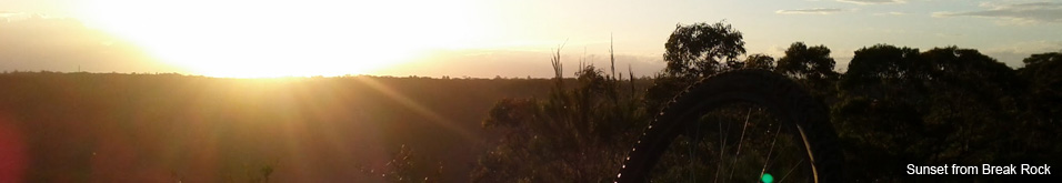
Fred Caterson Reserve (Castle Hill)
Golden Jubilee Field MTB Park (North Shore, Sydney)
Hassans Walls (Lithgow)
Hinze Dam (Gold Coast)
Jackson (Jackson)
Jindabyne (Snowy Mountains)
Kiwarrak State Forest (Tarree)
Majura Pines (Majura, Canberra)
Manly Dam (Northern Beaches, Sydney)
Mt Joyce (Gold Coast Hinterland)
Mt Kosciuszko (Snowy Mountains)
Nerang State Forest (Gold Coast)
Newnes (Lithgow)
Old Man's Valley (Hornsby, Sydney)
Ourimbah (Central Coast)
Oxford Falls (Northern Beaches, Sydney)
Pilot Wilderness (Snowy Mountains)
Red Hill (Northern Beaches, Sydney)
Rotorua Redwoods (New Zealand)
Silver Mountain (Kellogg)
Singleton (Hunter Valley)
Sparrow Hill (Kowen Pine Forest, Canberra)
St Ives and Belrose (North Shore, Sydney)
Stromlo Forest Park (Canberra)
Terrey Hills (Northern Beaches, Sydney)
The Oaks (Blue Mountains)
Thredbo Resort (Snowy Mountains)
Thredbo Valley Trail (Snowy Mountains)
Whistler Bike Park (Whistler)
Wingello (Southern Highlands)
Wylde MTB Trail (Cecil Park - Western Sydney)
Silver Mountain Bike Park - is there a better descent in the world?
WOW - Lithium Trail - Teton Pass, Jackson Wyoming
The not so enjoyable part of Mountain Biking in Whistler
Bottom of the World - Surviving Whistler Top to Bottom
Conquering Whistler's Top of the World Trail
Fantasy Enduro - Enduro World Series Fantasy Game
Is the Thredbo AM Trail the best descent in Australia?
MTB Trail Videos - Trail Centre Upgrade Program
VIDEO: The Fourth 365 Days of Reign - My 4th year of Mountain Biking
Pilot Wilderness Ride - Cascade to Pinch - Part 2
Pilot Wilderness Ride - Cascade to Pinch - Part 1
MTB Workout for the Deskbound
Finding Bruce Ridge and Loving It!
VIDEO: Top XC Rides of 2014/2015
VIDEO: 2015 The FAIL Awakens
VIDEO: Nine Days in the Rotorua Redwoods
Exploring all of Sparrow Hill and the East Kowen Forest
VIDEO: 365 Days of Reign - The Third (year of serious mountain biking)
The New Majura Pines and Sparrow Hill Trip
Mountain Biking in the NSW Snowy Mountains
About this website
This website is brought to you by MTB weekend warrior Aaron Markie.
On the scale of things Im a relative newbie to mountain biking. Unfortunately Im not lucky enough to have a bunch of MTB mates so I pretty regularly end up riding on my own, which is fine riding my local trails but when I travel to other locations I've found it quite daunting heading out without adequate trail knowledge. While there are plenty of great MTB trail websites out there it's rare to find a complete mix of info, maps, photos and videos.
The idea of this website is to tie those 4 elements together and give you a more detailed look at the MTB Trails Ive ridden.
I hope you get something out of this site and if you have anything to add then let me know.
How we make our maps
- I create my initial trails using the Map My Ride maps feature. I can either start with a trail I have mapped using my phones GPS or I start with a completely blank trail and draw it from scratch using their tools. Its really quite simple.
- Ive found Map My Ride's map creation tool much easier to use than the tools Google provide.
- After creating and saving the trail in Map My Ride I use the Download KML File feature on the right hand side to download the KML file to my computer.
- KML files are the Google map file format that allows for a lot of additional map features (like markers and image pop-ups etc). From what Ive found GPX files dont allow that, however GPX files seem to be more widely accepted as an importable file in most GPS software just for your info.
- For the tech heads you can open these KML files in any code/text editor and make changes. I usually change the <name> tag to something more meaningful than the default Map My Ride settings.
- I then open the KML file in Google Earth (the application, not in a browser). From here I use the Google Earth features to create markers for start, finish, trail names and other features on the map. I then save a new KML file by right clicking on the name of trail in the left hand column and choose Save Place As. Make sure you select the KML file type.
- One of the additional tricks here is that you can actually combine maps by loading up multiple KML files into Google Earth and then saving the place of the parent folder. Thats how we create our combined maps. Google Earth also gives you the power to colour up your trails and create different marker types. Its quite easy to use but Ive found it difficult to create trails.
- Then to create the embedded maps that sit in the website I go to http://maps.google.com and go to My Places then Create Map. After doing this it gives you the option to import your map. Click on import and then select your KML file.
- After the import is finished you should see your map, trail and any marker points on the right. If not, youve stuffed something up :)
- Ive found that in order to get the map embed code you have to go back to http://maps.google.com and click on my places again, otherwise it seems to create errors.
- Find the map in My Places, select the map you want to embed then you will see a link icon in the top right of the left column. After clicking you can copy the embed code or click on Customize and preview embedded map to change the size, zoom and other features (such as map, satellite, terrain).
It might seem like a lot of work, but the reality is you can spit out maps in just a few minutes. For example the trail section maps in the Red Hill only took about 5mins per map, this included drawing the trail from scratch, exporting, importing, adding the markers, exporting, importing, creating the embed code and inserting into my site).
I might do a video on this one day.