
Bantry Bay (Northern Beaches, Sydney)
Bruce Ridge (Canberra)
Bungarra Alpine Centre (Snowy Mountains)
Currumbin Border Track (NSW/QLD Border)
Daisy Hill (South Brisbane)
East Kowen (Kowen Pine Forest, Canberra)
Forest Pipeline (Northern Beaches, Sydney)
Fred Caterson Reserve (Castle Hill)
Golden Jubilee Field MTB Park (North Shore, Sydney)
Hassans Walls (Lithgow)
Hinze Dam (Gold Coast)
Jackson (Jackson)
Jindabyne (Snowy Mountains)
Kiwarrak State Forest (Tarree)
Majura Pines (Majura, Canberra)
Manly Dam (Northern Beaches, Sydney)
Mt Joyce (Gold Coast Hinterland)
Mt Kosciuszko (Snowy Mountains)
Nerang State Forest (Gold Coast)
Newnes (Lithgow)
Old Man's Valley (Hornsby, Sydney)
Ourimbah (Central Coast)
Oxford Falls (Northern Beaches, Sydney)
Pilot Wilderness (Snowy Mountains)
Red Hill (Northern Beaches, Sydney)
Rotorua Redwoods (New Zealand)
Silver Mountain (Kellogg)
Singleton (Hunter Valley)
Sparrow Hill (Kowen Pine Forest, Canberra)
St Ives and Belrose (North Shore, Sydney)
Stromlo Forest Park (Canberra)
Terrey Hills (Northern Beaches, Sydney)
The Oaks (Blue Mountains)
Thredbo Resort (Snowy Mountains)
Thredbo Valley Trail (Snowy Mountains)
Whistler Bike Park (Whistler)
Wingello (Southern Highlands)
Wylde MTB Trail (Cecil Park - Western Sydney)
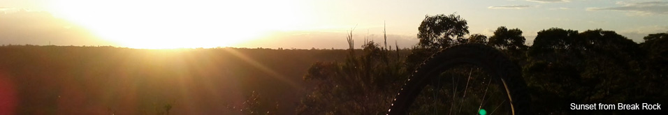
Terrey HillsLast Update: 25/10/2013
For full information, including maps, photos and detailed info on trail sections use the links on the right
Notes:
The Terrey Hills and Duffys Forest area has the longest ridable fire trails on the Northern Beaches. From primarily flat trails like Perimeter Trail 2 - Durumbil to Finish, Cullamine Track - Mallawa Rd to the Long Track, Chiltern North Track some undulating trails like Perimeter Trail 1 - Start to Durumbil, The Long Track, Cowan Track, Neverfail Gully Trail, Larool Trail and Cooyong-Aumuna Trail to some really steep climbs and descents on The Long Track - Final Section, Chiltern Track, Duckholes Track, Centre Track, Cooyong Track, Sandy Trail and Neverfail Gully Trail from Coonawarra Rd.
All of these trails can be linked up with short road sections to create a ride of well over 60km. Then to get really serious include the trails on the south side of Terrey Hills (Neverfail Gully Trail, Cooyong-Aumuna Trail, Cooyong Track, Sandy Trail, ), St Ives and Belrose and Oxford Falls for a truely outrageous XC adventure - perfect for long distance race training.
Sorting out the trail names
Depending on where you look and who you ask the actual section of trail called "Sandy Trail" can be quite different, even some online maps change the name of the trails in the area depending on how far you zoom in or out - which doesn't help at all!
The gate at Cooyong Road heading west (often referred to as Sandy Trail) is signposted as "Cooyong/Neverfail Trail" - but that is the only occasion where this naming convention appears and quite frankly it creates a lot of confusion so we've ignored it. It does make sense however to have the Cooyong Track start from Cooyong Road rather than start at some random point in the bush running off the Sandy Trail and linking up with the Ryland Track.
To add to the confusion the Ryland Track is by far and away the most sandy with huge unavoidable sandpits that are barely rideable and subsequently gets referred to as the Sandy Trail - but it's definitely called Ryland Track.
To add more fuel to the fire the trail commonly known as the Neverfail Gully Trail seems to have gone through an official change. The gates at Cooyong Road and at Coonawarra Road have signs for "Neverfail Gully Trail", while the gate at Aumuna Road (cnr of Coolowie Rd) has that section of trail signposted as "Cooyong-Aumuna Trail".
At the other end the trail commonly known as Duckholes Track technically starts from Mona Vale Rd with a single track down to the Duckholes Gate, which of course is an unauthorised trail for mountain bikers. The upper trail from McCarrs Creek Road to the Duckholes Gate is technically known as the "Terrey Hills Track" however no one seems to call it that so we've ignored it. Also the word Duckholes is sometimes spelt Duck Holes .. we've stuck with the former.
Confused?
So based on the best info we could find from various mapping sources, current signage and some logical decisions we decided to name the trails as follows.
Ryland Track: A fire trail on the north western side of Mona Vale Rd (over the road from Bunnings) down to the intersection of the Cooyong Track then turns west (left) and continues out to a dead end. Included within our St Ives and Belrose section.
Cooyong Track: From Cooyong Rd in Terrey Hills down to Kierans Creek, then up the other side ending at the Ryland Track (where the Ryland Track forks to the west).
Sandy Trail: From Killawarra Rd, Duffy's Forest to the Cooyong Track. The intersection of the Sandy Trail and Cooyong Track is at the top of the big climb north from Kierans Creek. (We've definitely shortened the Sandy Trail when compared to many other listings)
Neverfail Gully Trail: From Cooyong Rd to Coonawarra Rd (Once again major adjustments from other listings but the signs at the trailheads are pretty clear cut)
Cooyong-Aumuna Trail: From the end of Aumuna Rd (at the corner of Coolowie Rd near Kinma School) to the intersection of the Neverfail Gully Trail (at the bottom of the descents from Coonawarra Rd). This section is most often referred to as "Neverfail Gully Trail" but again the signage at the trailhead is clear cut.
Duckholes Track: From McCarrs Creek Rd down to McCarrs Creek Road :) We've ignored the unauthorised single track from Mona Vale Rd to the Duckholes Gate and the alternate name of Terrey Hills Track.
Blog articles that mention this trail
- 17/6/2016 - VIDEO: The Fourth 365 Days of Reign - My 4th year of Mountain Biking
- 7/5/2016 - Pilot Wilderness Ride - Cascade to Pinch - Part 2
- 1/1/2016 - VIDEO: 2015 The FAIL Awakens
- 28/6/2015 - VIDEO: 365 Days of Reign - The Third (year of serious mountain biking)
- 29/4/2015 - Long term test: Yakima Highroller and Whispbar roof rack
- 26/1/2015 - VIDEO: 2014 FAILS - Will Ride, Will Fail
- 17/6/2014 - 365 Days of Reign - My 2nd Year on a real mountain bike
- 1/1/2014 - 2013 Another Year of #FAIL
- 14/12/2013 - Merry Christmas from MTB-TV - What a year its been
- 19/9/2013 - The Lone Wolf enjoys some group action
- 28/5/2013 - Bantry Bay and Forest Pipeline trails now up
- 24/5/2013 - 365 Days of Reign - My 1st Year on a Real Mountain Bike
- 16/4/2013 - Loving the Thredbo Flow Trail
- 13/3/2013 - MTB tyre pressure matters - who would have thought?
- 6/3/2013 - I'm back on the bike
- 14/2/2013 - #ThursdaysTrail - The Cowan Track - Terrey Hills