
Bantry Bay (Northern Beaches, Sydney)
Bruce Ridge (Canberra)
Bungarra Alpine Centre (Snowy Mountains)
Currumbin Border Track (NSW/QLD Border)
Daisy Hill (South Brisbane)
East Kowen (Kowen Pine Forest, Canberra)
Forest Pipeline (Northern Beaches, Sydney)
Fred Caterson Reserve (Castle Hill)
Golden Jubilee Field MTB Park (North Shore, Sydney)
Hassans Walls (Lithgow)
Hinze Dam (Gold Coast)
Jackson (Jackson)
Jindabyne (Snowy Mountains)
Kiwarrak State Forest (Tarree)
Majura Pines (Majura, Canberra)
Manly Dam (Northern Beaches, Sydney)
Mt Joyce (Gold Coast Hinterland)
Mt Kosciuszko (Snowy Mountains)
Nerang State Forest (Gold Coast)
Newnes (Lithgow)
Old Man's Valley (Hornsby, Sydney)
Ourimbah (Central Coast)
Oxford Falls (Northern Beaches, Sydney)
Pilot Wilderness (Snowy Mountains)
Red Hill (Northern Beaches, Sydney)
Rotorua Redwoods (New Zealand)
Silver Mountain (Kellogg)
Singleton (Hunter Valley)
Sparrow Hill (Kowen Pine Forest, Canberra)
St Ives and Belrose (North Shore, Sydney)
Stromlo Forest Park (Canberra)
Terrey Hills (Northern Beaches, Sydney)
The Oaks (Blue Mountains)
Thredbo Resort (Snowy Mountains)
Thredbo Valley Trail (Snowy Mountains)
Whistler Bike Park (Whistler)
Wingello (Southern Highlands)
Wylde MTB Trail (Cecil Park - Western Sydney)
Mt KosciuszkoLast Update: 21/1/2013
For full information, including maps, photos and detailed info on trail sections use the links on the right
Notes:
The NSW Snowy Mountains MTB scene rapdily expanding. Ive decided to keep all the trail locations separated even though some are quite close to each other (and some will one day join up). Sections are: Jindabyne (trails around the dam), Bungarra Alpine Centre, Thredbo River including Lake Crackenback Resort and Spa, Thredbo Resort, Mt Kosciuszko, Perisher (still to come). Rolling Ground have a selection of Snow Mountains MTB Trail Maps available for download
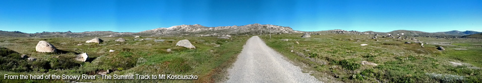
There are a number of trails heading to Mt Kosciuszko however there is only one trail where you are allowed to ride your bike. The Summit Trail leaves from the end of the Kosciuszko Rd above Charlotte Pass Ski Resort and runs 7.7km to Rawson Pass.
You are not allowed to take bikes beyond the Rawson Pass NPWS station. The Rawson station has toilets, protection from the elements and bike racks to lock your bike. Its a 1.67km walk to the top of Mt Kosciuszko along the Summit Walking Track (40 mins one way). Apparently people ride to the top and back down, however it is illegal and the NPWS are well within their rights to fine you.
Before heading out on the trail check with the NPWS on the trail status, there is a NPWS visitors centre in Jindabyne (next to Nuggets Crossing) or at the park gates at Sawpit Creek (along the Kosciuszko Rd).
NOTE: The flies are nasty. You will see at the start of the video I veer off course a little that was me trying to get a biting horsefly off my sock (they prefer socks to landing on your skin?).
IMPORTANT: Being in an alpine region the weather can go from blisteringly hot to near freezing within a few hours (in early January I rode out at 9am and it was 9ºC, however on subsequent days it was already approaching 30ºC by 9am). Check the forecast before heading out, carry additional clothing, have wind and sun protection and carry plenty of water. There is no phone reception along this trail.
Blog articles that mention this trail
- 1/6/2015 - Mountain Biking in the NSW Snowy Mountains
- 14/12/2013 - Merry Christmas from MTB-TV - What a year its been
- 24/5/2013 - 365 Days of Reign - My 1st Year on a Real Mountain Bike
- 14/3/2013 - #ThursdaysTrail - Mt Kosciuszko - The highest ride in Australia
- 26/1/2013 - The Summer of MTB
- 2/1/2013 - The January 2013 MTB Bucket List