
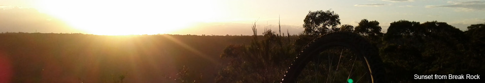
Bantry Bay (Northern Beaches, Sydney)
Bruce Ridge (Canberra)
Bungarra Alpine Centre (Snowy Mountains)
Currumbin Border Track (NSW/QLD Border)
Daisy Hill (South Brisbane)
East Kowen (Kowen Pine Forest, Canberra)
Forest Pipeline (Northern Beaches, Sydney)
Fred Caterson Reserve (Castle Hill)
Golden Jubilee Field MTB Park (North Shore, Sydney)
Hassans Walls (Lithgow)
Hinze Dam (Gold Coast)
Jackson (Jackson)
Jindabyne (Snowy Mountains)
Kiwarrak State Forest (Tarree)
Majura Pines (Majura, Canberra)
Manly Dam (Northern Beaches, Sydney)
Mt Joyce (Gold Coast Hinterland)
Mt Kosciuszko (Snowy Mountains)
Nerang State Forest (Gold Coast)
Newnes (Lithgow)
Old Man's Valley (Hornsby, Sydney)
Ourimbah (Central Coast)
Oxford Falls (Northern Beaches, Sydney)
Pilot Wilderness (Snowy Mountains)
Red Hill (Northern Beaches, Sydney)
Rotorua Redwoods (New Zealand)
Silver Mountain (Kellogg)
Singleton (Hunter Valley)
Sparrow Hill (Kowen Pine Forest, Canberra)
St Ives and Belrose (North Shore, Sydney)
Stromlo Forest Park (Canberra)
Terrey Hills (Northern Beaches, Sydney)
The Oaks (Blue Mountains)
Thredbo Resort (Snowy Mountains)
Thredbo Valley Trail (Snowy Mountains)
Whistler Bike Park (Whistler)
Wingello (Southern Highlands)
Wylde MTB Trail (Cecil Park - Western Sydney)
The OaksLast Update: 7/1/2013
For full information, including maps, photos and detailed info on trail sections use the links on the right
Notes:
I was quite concerned about my first ride at the Oaks. It was going to take me a LONG way away from civilization and if something went wrong what happened if no one was on the trail? HA! I caught the Sunday 8:23am train from Glenbrook to Woodford and around 50 MTBers got off the train with me.
If you are doing this ride on a weekend morning then you are pretty much guaranteed to be amongst a crowd. I would recommend doing your first Oaks ride this way and I would also recommend getting out early in the morning because there are some lung busting climbs. I did it with sub 20C temps on a cloudy day and the first half of the ride (to the Helipad) just about beat me.
If you are riding this trail on a weekend morning and you are the only MTBer it might be worth getting on your phone and working out why (bush fires, back burn, flood over the causeway, dinosaur resurgence, alien invasion?). This is a popular track! You are going to come across a lot of riders (keep left, say hello, ride with a smile).
IMPORTANT - CHECK THE STATUS OF THE CAUSEWAY WITH THE NPWS BEFORE YOU HEAD OFF - Its a long way back if you can't cross the river.
You can of course ride this trail in reverse but its likely to take you twice as long because the ride from the Helipad to the Causeway is all downhill. Seriously .. don't try this in reverse until you've ridden it "the easy way" first.
TIME ESTIMATES - This trail can be ridden by anyone with fire trail experience, but from a fitness point of view it will be a fair slog for social riders. While I am overweight and unfit I really pushed myself hard with very few breaks and it took me 1:43 (see breakdown below). I suspect that most social riders would take at least 2 hours, but depending on the weather and your experience it might be anywhere up to 3-4 hours.
TAKE SPARES - while the trail is well travelled, if you have a flat mid trail its going to be a VERY long walk out.
TAKE WATER - the first half of the ride is very taxing and theres no water along the way. There is a tap at the Woodford National Park gate, make sure you are topped up.
PARKING - Parking at Glenbrook Station and catching the train to Woolford seems to be the most popular way of taking on this trail. There is plenty of parking at Glenwood. There is also parking at Woolford Station, near the entrance to the National Park and inside or outside the National Park at the Glenbrook end.
FOOD AND DRINK - Apparently there isn't much going on at Woolford, so you are probably better off bringing it with you. There is a tap at the start of the fire trail at the Woolford end. Glenbrook has plenty of cafes, bakeries and fast food joints to replenish your energy reserves and if you can't find a table there is a park and picnic area at the top end of the shops (towards the highway).
GETTING THERE - If driving from Sydney Glenbrook is the first major stop as you climb from Emu Plains up the mountains. Take a left off the highway and make your way towards the shops on the southern side of the highway. The railway station is down the hill from the shops. If catching the train (they run from Central) make sure that it stops at Woodford.
For more detailed info on this trail visit Fat Hippy
A rough breakdown of my first attempt at the Oaks Trail.
4 min - Station to Trail Head - Cruising
Break (1 min)
42 min - Trail Head to Helipad (+2 min toilet)
Break (2 min)
11 min - Helipad to Single Track
Break (2 min)
22 min - Single Track (+1 min navigation check)
Break (5 min)
14 min - Road home (+1 min break) - Cruising (but torturous)
Blog articles that mention this trail